WHAT WE DO
Surveying
Topographical Surveys
Topographical surveys are a critical first step in any land development project. Our high-tech equipment and well-trained staff can quickly obtain site data at whatever level of detail you or your architect may require. We have the ability to cover large areas with our UAV (drone) and can also overlay data on a high-resolution aerial photo. We can supply all 3d data and imagery in digital formats that can be imported directly into your architect’s design software.
Contact us for more informationBoundary Surveys
Unsure where your property boundaries are? We can easily locate and mark the exact position of your boundary lines. We can stake the line of your boundary for fencing or locate your original survey peg positions. We can also complete a reinstatement survey, including preparing and lodging an associated plan with LINZ if you require official boundary marks/pegs to be placed.
Contact us for more informationEasement and Covenant Surveys
Easements and covenants are rights over land. The extent of these rights are required to be defined by survey before they can be registered on your title. We commonly complete easement surveys for new electricity lines and transformers, pipelines, and access (rights of way). We also typically complete covenant surveys for building platform locations, building height restrictions, and vegetation protection.
Contact us for more informationBuilding Setout and Certification
We ensure the correct location and floor levels for your new build and provide a surveyor’s certificate to confirm this. Councils often require a surveyor’s certificate to prove that buildings have been positioned correctly.
We commonly establish height datums on sites for contractors and builders to work from, and we also provide initial set-outs for earthworks / site-scrapes and high accuracy set-out of buildings and other features.
Contact us for more informationConstruction Setout
We utilise high-accuracy measuring techniques for specialist applications, such as set-out and as-built surveys for power stations and cell phone towers, monitoring of retaining walls, and siting of large and/or prefabricated structures.
We also provide set-out and as-built to the required level of accuracy for all infrastructure in subdivisions.
Contact us for more informationLT Surveys
Land Transfer (LT) surveys are essential for recording the ownership of land and these can only be prepared by Licensed Cadastral Surveyors. It is essential that an LT survey is accurate and includes all relevant information. Our Licensed Cadastral Surveyors have many years of experience and a vast knowledge of the NZ cadastral system. Over the years, we have prepared some of New Zealand’s largest and most complex survey datasets, and we have helped to shape the New Zealand cadastral system. Our comprehensive QA processes ensure that the cadastral datasets that we submit to Toitū Te Whenua Land Information New Zealand are detailed, complete and fully compliant with Cadastral Survey rules.
Contact us for more informationTopographical surveys are a critical first step in any land development project. Our high-tech equipment and well-trained staff can quickly obtain site data at whatever level of detail you or your architect may require. We have the ability to cover large areas with our UAV (drone) and can also overlay data on a high-resolution aerial photo. We can supply all 3d data and imagery in digital formats that can be imported directly into your architect’s design software.
Contact us for more informationUnsure where your property boundaries are? We can easily locate and mark the exact position of your boundary lines. We can stake the line of your boundary for fencing or locate your original survey peg positions. We can also complete a reinstatement survey, including preparing and lodging an associated plan with LINZ if you require official boundary marks/pegs to be placed.
Contact us for more informationEasements and covenants are rights over land. The extent of these rights are required to be defined by survey before they can be registered on your title. We commonly complete easement surveys for new electricity lines and transformers, pipelines, and access (rights of way). We also typically complete covenant surveys for building platform locations, building height restrictions, and vegetation protection.
Contact us for more informationWe ensure the correct location and floor levels for your new build and provide a surveyor’s certificate to confirm this. Councils often require a surveyor’s certificate to prove that buildings have been positioned correctly.
We commonly establish height datums on sites for contractors and builders to work from, and we also provide initial set-outs for earthworks / site-scrapes and high accuracy set-out of buildings and other features.
Contact us for more informationWe utilise high-accuracy measuring techniques for specialist applications, such as set-out and as-built surveys for power stations and cell phone towers, monitoring of retaining walls, and siting of large and/or prefabricated structures.
We also provide set-out and as-built to the required level of accuracy for all infrastructure in subdivisions.
Contact us for more informationLand Transfer (LT) surveys are essential for recording the ownership of land and these can only be prepared by Licensed Cadastral Surveyors. It is essential that an LT survey is accurate and includes all relevant information. Our Licensed Cadastral Surveyors have many years of experience and a vast knowledge of the NZ cadastral system. Over the years, we have prepared some of New Zealand’s largest and most complex survey datasets, and we have helped to shape the New Zealand cadastral system. Our comprehensive QA processes ensure that the cadastral datasets that we submit to Toitū Te Whenua Land Information New Zealand are detailed, complete and fully compliant with Cadastral Survey rules.
Contact us for more informationOur Projects
The Grampians
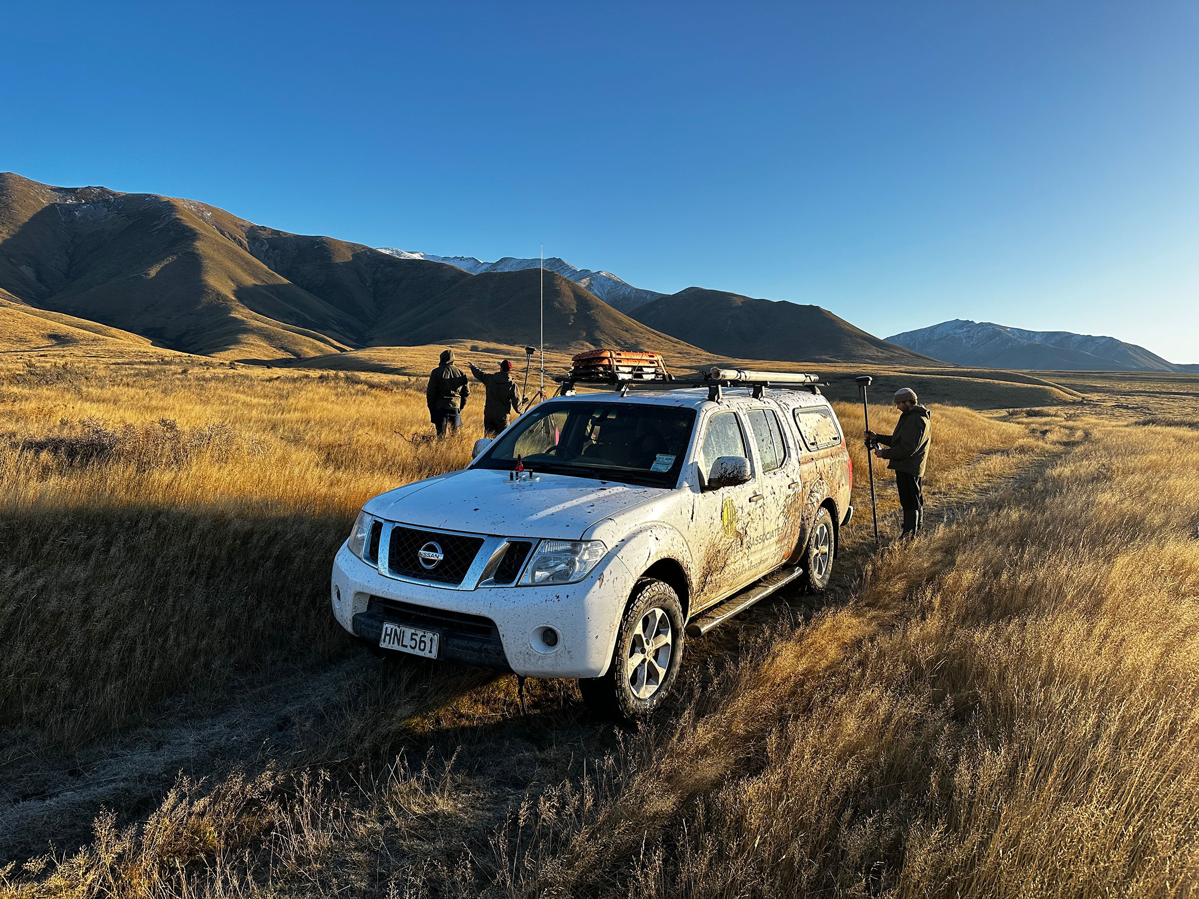
In 2023 Coterra worked on the large-scale rural survey for the tenure review of The Grampians.
Our Projects
The Grampians
In 2023 Coterra worked on the large-scale rural survey for the tenure review of The Grampians.